
Route Length

Max Altitude

Trek Duration

Trek Difficulty

Base Camp Area

Pickup Point
10+ Years Age
First timer can apply, previous trekking experience is more appreciated.
Cover 5 km of distance in 30 minutes without a stress.
+917055048487, +917055048488
trekkingcompass@gmail.com
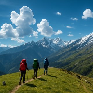
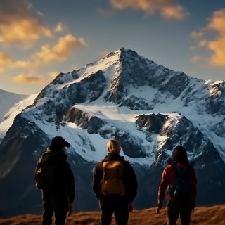
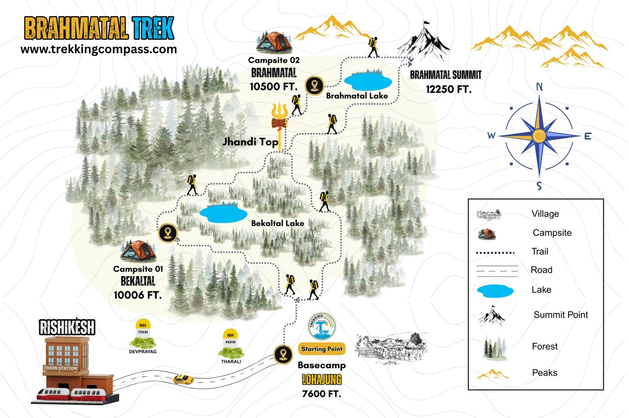
Brahma, the Hindu God with hardly any traces on this Earth, left something unforgettable. This place in a league of its own is Brahmatal; a lake believed to be created with meditation and creation in mind. Brahmatal Trek is the way to and fro from this majestic beauty in the lap of the mountains in Chamoli district, Uttarakhand.
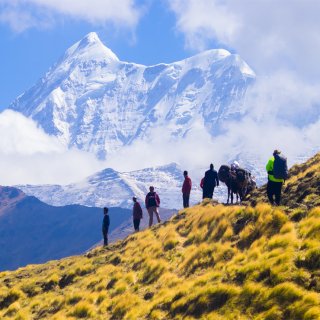
The trek is unique and unrivalled in its views, apart from the two lakes: Bekaltal and Brahmatal. The Indian Himalayas do not seem far away once you are paramount on the summit climb of Brahmatal Trek. At an altitude of 12,250 ft, it's all about nature's grandeur and statuesque. The snow-covered Mt. Trishul, Mt. Nanda Ghunti and respective ranges reflecting the sun's hue are mesmerising and arresting.
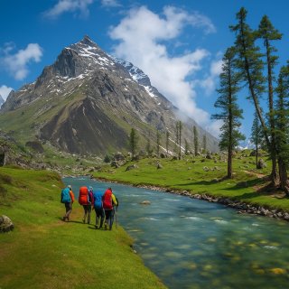
This trek is about flora, fauna, culture, and spirituality. You get folktales from Mahabharata, you get temples to confirm your beliefs. There are rattling and whistling birds. The bewitching oak and rhododendron trees and forests will compel you to look further and you'll find yourself staring at the wildlife. It includes Himalayan foxes, Barasingha, Himalayan wild goats (white and black), White bears, and Ibex/Thar. Monals (the state bird) are a rare and pleasant sight on the Brahmatal Trek. The more you explore, the 24 kms (approx.) and 5 days long trek, the more dumbfounded you'll be.
Brahmatal Trek starts from Rishikesh/Dehradun/Kathgodam and makes a full circle. On your way to Lohajung, you'll be met with different explore-worthy places like Rudraprayag, Karnaprayag, etc. It's the safest winter trek available that favours both beginners and experienced trekkers because of its easy to moderate difficulty level. Unlike other treks, Brahmatal Trek is beautiful in Spring and Autumn too. To experience views that hold you captive, Brahmatal Trek is a must-visit.
Lohajung Altitude: 7,550 ft (2,316 m)
Altitude Gain: 6430 ft (1976 m)
Travel Distance: 260 km
Travel Hours: 10 to 11 hours
Today starts with an early morning meet-up with our transport manager at starting points: Dehradun, Rishikesh, and Kathgodam. The journey then takes you to Lohajung, the base camp for the Brahmatal Trek, which can be reached via different routes.
Different routes, but the same destination. Those who choose to stay the night at Dehradun will need to travel extra miles (298 km approx.) to reach Rishikesh and then Lohajung. Their travel hours will be approximately 12-13 hours. Trekkers who start at Rishikesh will travel a total of 260 km to reach Lohajung. It'll take a 10-11 hours long drive.
While travelling to Lohajung from Dehradun and Rishikesh, they will get a peek at the Indian Himalayan Tops. As the route takes them ahead, they'll get glimpses of 3 of the 5 confluences: Devprayag, Rudraprayag, and Karnaprayag. At Devprayag the ‘SANGAM’ of Alaknanda and Bhagirathi will hold you still. A little further into your journey through the hilly roads and pine forests, you'll meet the mythical Dhari Devi Temple. The removal of this temple is believed to have brought about the Uttarakhand floods of 2013.
Driving ahead on the road, you'll pass by Rudraprayag (the confluence of Alaknanda and Mandakini) and Karnaprayag (where Alaknanda and Pindar rivers meet). As the day transcends, you'll find yourself reaching Lohajung. It's a pretty village with an even prettier view of Mt. Nanda Ghunti. The village that got its name from a war (jung) between Goddess Parwati and Lohasur has awe-striking views of sunset and sunrise. Don't worry about the chilly evenings at Lohajung, they are perfect for some dearly-appreciated bonfire.
Bekaltal Altitude: 10,006 ft (3,049 m)
Altitude Gain: 1650 ft (502.92 m)
Travel Distance: 06 km
Travel Hours: 5 to 6 hours
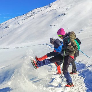
Today marks the beginning of the trek and a morning with a picturesque view of Mt. Nanda Ghunti and the following ranges. The trek starts from Lohajung Chowk and extends to the small villages nestled on and around the trail. This muddy trail ascends right behind Lohajung. During winters, this trail going into moderately dense forests of oak, rhododendron, and deodar trees is slippery but easily doable nonetheless.
When trekkers look around, they find themselves to be a part of these mountains and nature. Not far ahead, you'll encounter Mundoli, a small village with children and people on a regular hike of their own. When you look below, you'll see Kali Valley (here Pindari and Kali rivers join).
With each step into the trail through the forest, you'll hear the birds chirping. It'll add up to a paramount experience in your time of trekking. The birds who are usually heard around here are Blue-fronted redstart, Asian barred owlet, Himalayan woodpecker, and solitary snipe. Today's campsite Gujreni is popular for birdwatching. Nestled between the larger-than-life trees of rhododendrons, green oak, and brown oak, it forms a perfect spot for birdwatching.
If you take a 50-minute uphill walk from Gujreni, you'll reach Bekaltal (10,006 ft); the star of the day! It's surrounded by deodar and oak trees all around, giving it a feeling no less than Narnia. The lake is covered in a snowy sheath during winter. Standing there you'll feel lost in time, frozen, but free. The frozen lake will entice you to skate over it, we'd recommend avoiding it. There's no certainty whether the ice layer can handle your weight or not.
Brahmatal Altitude: 10,500 ft (3200 m)
Altitude Gain: 1,944 ft (593 m)
Travel Distance: 08 km
Travel Hours: 7 to 8 hours
Today takes you to Brahmatal (the destination all along). After the morning breakfast, the trek begins with a spellbinding sunrise. It's a long day today as the trek includes reaching Tilandi Top to Jhandi Top and finally to the Brahmatal campsite.
Trekkers will walk the steep trail right above Bekaltal Lake and enter a dense oak and rhododendron forest. When you enter, you'll have different views for different seasons. For winters, the forest will be all in white, the trees will have their canopies blanketed with snow. If you trek during spring, the trail within the forest and the forest will be shimmering with vibrant shades of pink and mauve.
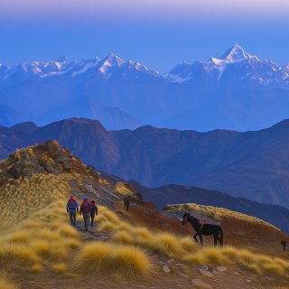
Out of the forest, you'll be greeted by a small meadow called the Tilandi Top (10,495 ft). It won't be green during the winters but will be covered in knee-deep snow for you to explore all you want. If you look around, you'll see unparalleled and stunning views of mountain ranges. Below you can see the valley connecting Lohajung to Wan. The panoramic view of Mt Trishul and Mt Nanda Ghunti alongside the related ranges is phenomenal.
Next up is a walk along the ridge that leads you to Jhandi Top (the ridge's highest point) at an altitude of 11,500 ft. If the views from Tilandi Top baffle you then the view of the entire Roopkund trail will potentially keep you spellbound for a lifetime to come.
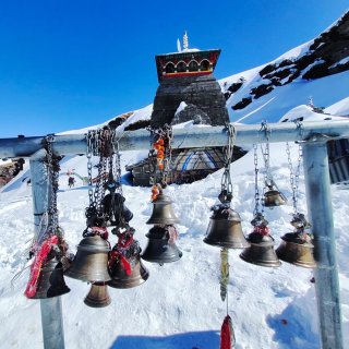
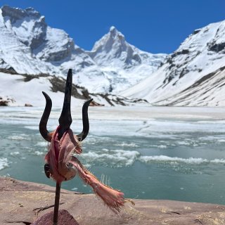
Once you descend the peak, you'll find Brahmatal (10,500 ft); frozen and majestic. The local myth of Brahma Ji meditating here while writing the Vedas is undeniable seeing the serene glory of the place. That one tree accompanying the lake is nothing short of the Kalpavriksh from Hindu Mythology; majestic, unreal, heavenly.
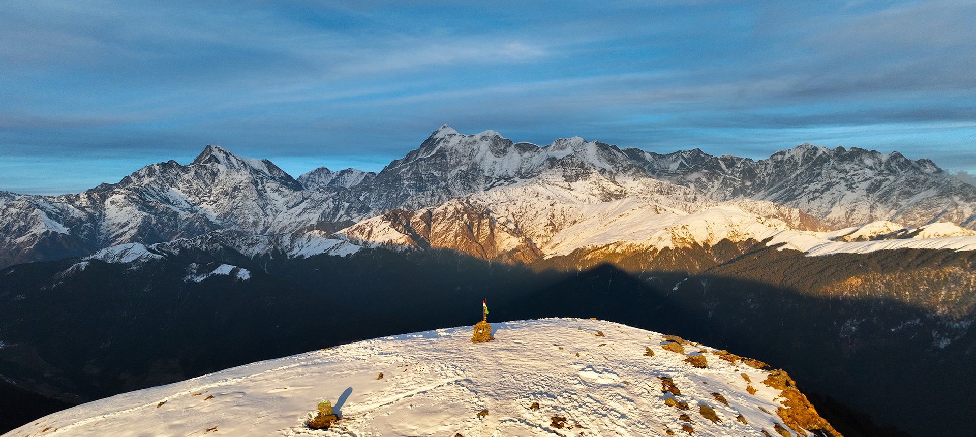
Brahmatal Summit Altitude: 12,250 ft
Lohajung Altitude: 7,550 ft (2,316 m)
Altitude Loss: 4,700 ft (1432 m)
Travel Distance: 09 to 10 km
Travel Hours: 8 to 9 hours
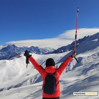
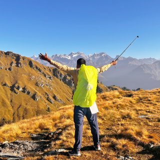
Today starts at the Brahmatal campsite where the trek ahead is to the summit climb near Brahmatal campsite. You'll start the day by witnessing sunrise from 12,250 ft; a second-to-none experience. Standing at the summit point, you will see the Himalayan ranges, but larger than life. The view on the other side is equally majestic as a range of hills appears to extend into infinity. They are painted in different shades of blue; dark and light. Every trek has a unique view to gift, but Brahmatal sweeps away the crown for it. Like Chaukhambha from Deoriatal Chandrashila, Bandarpoonch from Dayara Bugyal, and Trishul Massif from Brahmatal. That's not all, the view also consists of Mt. Shivling and Mt. Neelkanth.
Then starts a familiar trek back to the Brahmatal basecamp (Lohajung). It'll be a downhill trek to Lohajung along the ridge back from the Jhandi Top. Slowly, all the giant-sized mountains and the panoramic view of Mt. Nanda Ghunti and Mt. Trishul with related ranges will diminish in size. Only the tops of a few like Mt. Nanda Ghunti will be remaining.
The trekkers will walk back on the trail inside and out of dense oak and rhododendron forests. They'll relive and cherish their experience during the trek. While descending the 8.5 km and 8 to 9 hours long trek to Lohajung, they'll bid adieu to the snowy trails, the chirping monals, and the locals they meet on their way.
Once back at Lohajung, they'll have plenty of time to soak in the sunset, the reddish-orange painted sky and Mt. Nanda Ghunti. Alongside this, you can explore the local market at Lohajung and find a memorandum. Take a good night’s sleep, there is a long journey tomorrow.
Rishikesh Altitude: 1,120 ft (340 m)
Altitude Loss: 6430 ft (1960 m)
Travel Distance: 260 km
Travel Hours: 10 to 11 hours
At the break of dawn, trekkers will board their vehicles, and say goodbye to Lohajung, the Himalayan range, their fellow trekkers, guides, and the locals. The journey back home will be 10-12 hours long to Rishikesh.
If you wish to stay and explore Lohajung more, you can lodge at a hostel, hotel, or homestay. For trekkers looking to explore Uttarakhand more, they should return from the Kathgodam route. On your way back, you'll find Nainital, Katarmal Sun Temple, Almora, Ranikhet, Kainchi Dham, Jageshwar Temple, Bhimtal, Naukuchiatal Tal, Chitai Golu, Baijnath etc.
Brahmatal Trek Elevation Chart & Route Map


Accommodation
Meals (Vegetarian only with eggs option available)
Nutritious meals from Day 1's dinner to last day's breakfast, following the itinerary schedule.
Expert Support
First Aid Preparedness
Fully equipped medical kit including a stretcher, oxygen cylinder, blood pressure monitor, oximeter, and stethoscope to ensure safety throughout the journey.
Storage Facilities :- A secure room at the base camp to store additional luggage not needed during the trek.
Permits and Entry Fees :- Coverage of all necessary permits and entry fees, in line with standard charges for Indian nationals.
Transportation :- A round-trip transport from the pick-up point and back at the same point as a part of the itinerary.
Trek Equipment
Insurance :- Personal insurance is mandatory and not included in the package.
Personal Expenses :- Any expenses of a personal nature, including shopping, snacks, hiring a mule or porter for carrying your belongings, or acquiring personal equipment.
Emergency Costs :- Expenses arising from emergency evacuations, hospitalization, or any medical treatments required.
Unspecified Services :- Any services or items not explicitly mentioned under the "INCLUSIONS" section.
Food Costs :- We will not cover any food costs during your transit to and from the base village.
Trekking is not only about enjoying the change of scenery but also about being responsible. Our (Trekking Compass) responsibility is to provide you with an opportunity for a safe trek. But, how do we do that? We do that when you fulfill your end of the responsibility and are honest with us. To keep you safe we need to be sure there isn’t any inherent threat to your being.
Treks are at higher altitudes and it becomes difficult, almost impossible to provide you with immediate medical assistance. Therefore, we cannot help you if you don’t help us. Trekking is only one of the things you can do, but there are plenty of other things to do too. Don’t risk your life for the thrill.
To approach a trek with utmost safety, we want you to submit the following documents:
Personal Confirmation Statement (Compulsory for anyone over 18 years)
You are participating in a trek at high altitudes and it comes with its own sets of risks. This Personal Confirmation Statement will make sure that you understand all the risks you're buying into. Trekking Compass wants you to confirm your complete understanding of these risks so that you come prepared for any mental or physical challenges ahead.
This statement is also a declaration from you that, "All the information I have provided, including medical conditions, is true. If found false under any circumstances, I will be held accountable and it has nothing to do with Trekking Compass."
We have the utmost empathy for you and will do our best to help wherever possible, but only after assessing your readiness and safety for the trek. This is how our team will adequately prepare for whatever risks we might face during the journey. Concerning individuals are requested to thoroughly cross-check the requirements and only then sign the document.
Parent/Guardian Approval Statement (Compulsory for anyone below 18 years)
For participants under 18 years of age, the Parent/Guardian Approval Statement is essential to confirm that a legal guardian understands and consents to the participation in the trek. Once we have this document, we are affirmed that the parent or guardian is fully aware of the risks involved in trekking at high altitudes and is consenting to their child's participation.
No underage (below 18+) children are welcome on the trek without their parent's consent. Submission of this document reassures us that parents are approving that their child meets the health and fitness requirements for the trek, after a thorough examination.
This legal confirmation holds the parent liable for any discrepancies, freeing Trekking Compass from any liabilities for the same. Parents are requested to thoroughly cross-check the requirements and only then sign the document.
Medical Liability Waiver
The Medical Liability Waiver makes sure participants acknowledge the health risks associated with trekking at high altitudes. Common ailments during treks include altitude sickness, dehydration, muscle cramps, hypothermia, and fatigue, all of which can significantly affect your trekking experience. Additionally, weather changes and the physical demands of the terrain may exacerbate pre-existing conditions.
If you have pre-existing medical conditions such as asthma, diabetes, or heart issues, it’s vital to inform us and carry your necessary medications. Trekking Compass cannot provide immediate medical assistance in remote areas, so having the essential medications, such as inhalers, insulin, or any other prescriptions, is crucial for your safety during the trek.
By signing this waiver, you confirm that you are in good health and have taken the necessary precautions. You acknowledge these risks and agree not to hold Trekking Compass liable for any medical issues or accidents that may arise during the trek.
For any further doubts about anything mentioned above, below is our contact information:
OFFICE ADDRESS: Lane No. 4 Krishna Vihar Mohkampur, Dehradun, Uttarakhand, 248005
PHONE NUMBER: +91 7055048487, 7055048488
EMAIL ADDRESS: info@trekkingcompass.com
HOW TO REACH ? (RISHIKESH)
Note: Keep a buffer day in your getaway in addition to the total days in the itinerary. This day will come in handy in case of any political unrest, landslides, or rains. If not, you can use the extra day to get to know Rishikesh. This means that for an itinerary ending on the 15th of a month, book your return tickets for the 16th.
What are the different ways to reach Rishikesh?
On the Brahmatal trek, our first long-day trip is from Rishikesh to Lohajung (260 km). Therefore, trekkers need to reach Rishikesh to start the trek. The first move to reach Rishikesh for any trekker is to reach either Dehradun or Delhi. Later, every trekker can choose their choice of transport. The available transports for Rishikesh are:
Medium: BUS
A Friendly Note: You should travel by government buses instead of private ones because the private buses tend to take more time than expected. To avoid missing the pick-up time, try traveling by government bus, wherever possible.
Medium: TRAIN
Medium: FLIGHT
Fly Directly to Dehradun and then to Rishikesh: To fly directly at Jolly Grant Airport Dehradun, there are multiple flights from metropolitan cities. The companies that facilitate these flights are:
Fly to Delhi then take a bus or train to Rishikesh: It’s very easy to fly to Delhi from anywhere in the country and take a bus to Rishikesh. You will find a detailed description of buses in the BUS section. The companies that facilitate these flights to Delhi are:
Note: Make sure that the mode of transport you choose should bring you to Rishikesh a day before Day 1, i.e., Day 0. You can fly to Delhi and Dehradun from Mumbai, Kolkata, Bengaluru, Chennai, Hyderabad, Pune, and to Dehradun from Delhi too.
What happens on the drop-off day
Here are the points that explain your drop-off:
Special Case: What if you miss our pick-up?
You shouldn't panic and follow one of the below-mentioned ways to Lohanjung:
| Backpack with rain cover / Trolley Bag | Main bag for gear. |
| Day pack with rain cover (20 - 30 L) | For day essentials, if the main pack is off-loaded. |
| Walking stick | Recommended (at least one). |
| Water bottle/ Hydration pack | 2 bottles (1L each) or 1 hydration pack and 1 bottle. |
| Snacks | Energy bars, dry fruits, ORS/electrolytes. |
| Personal Medical Kit | As prescribed by your doctor. |
| T-shirts (Synthetic, quick-dry) | 2 full-sleeve, 2 half-sleeve. |
| Fleece T-shirts | 2 pieces. |
| Wind-stopper / Fleece jacket (upper) | 1 piece. |
| Windproof jacket | 1 piece |
| Down feather / Hollow jacket | 1 piece |
| Thermal innerwear (Upper & Lower) | 1 set. |
| Trekking pants (Synthetic, quick-dry) | 3 pairs. |
| Wind-stopper / Fleece pants (lower) | 1 pair. |
| Waterproof gloves | Not required. |
| Fleece / Woolen gloves | 1 pair. |
| Poncho / Waterproof jacket and pants | 1 set. |
| Head torch / Hand torch | 1 piece. |
| Sun cap | Required. |
| Woolen cap | 1 piece. |
| Balaclava | 1 piece. |
| Buff/ Neck gaiters | 1 synthetic, 1 woolen. |
| Sunglasses | UV protection with side covers (for spectacle users: contacts or photochromatic lenses). |
| Trekking shoes (waterproof, high ankle, good grip) | 1 pair. |
| Floaters / Flip-flops | 1 pair. |
| Cotton socks | 4 pairs. |
| Woolen socks | 2 pair. |
| Sunscreen | 1 piece. |
| Moisturizer | 1 piece. |
| Lip balm/ Chap-stick | 1 piece. |
| Toothbrush and toothbrush | 1 set. |
| Toilet paper and wipes | 1 pack each. |
| Soap/ Hand sanitizer | 1 piece. |
| Quick-dry towel | 1 piece. |
The Brahmatal Trek is one of the most popular winter Himalayan treks in Uttarakhand, known for its frozen alpine lake, panoramic views of towering peaks like Mt. Trishul and Mt. Nanda Ghunti, and its snow-covered forests. The trek derives its name from Brahmatal Lake, where mythology says Lord Brahma meditated. Unlike other treks that shut down in peak winter, Brahmatal is open and accessible in snow season, which makes it especially attractive to beginners and snow enthusiasts. What makes it truly special is the chance to trek through ancient oak and rhododendron forests, camp near frozen lakes, and climb up to Brahmatal Top where 360° Himalayan views unfold.
The trek is most famous as a winter trek, best done from December to February when the trail is carpeted in snow, the lake freezes, and the forests look magical. This is the time when trekkers can experience the thrill of walking on snow, setting up camps in a winter wonderland, and witnessing Trishul and Nanda Ghunti in their snowiest form. In March and April, the snow begins to melt, giving way to blooming rhododendrons that paint the forest trails red and pink. Trekkers who prefer fewer crowds and clearer skies often choose the post-monsoon season (October–November), when the mountains are sharply visible, though the lake isn’t frozen yet.
Brahmatal is considered an easy to moderate trek, which makes it one of the best options for beginners and families. The daily walking distance is manageable, usually between 6–8 km, and the trail has gradual ascents rather than steep climbs. However, in peak winter, walking in snow can be physically demanding and requires extra stamina. Compared to other winter treks like Kedarkantha, Brahmatal has slightly longer walking days, but the altitude remains comfortable at under 4,000 m, which reduces the risk of altitude sickness.
The trek covers about 24 km in total and takes 5 to 6 days depending on the chosen itinerary. The journey begins from Lohajung village (2,300 m), which is the base camp. From Lohajung, trekkers pass through forests and meadows to reach campsites like Bekaltal and Brahmatal. Each trekking day involves 4–6 hours of walking, making it relatively less strenuous compared to high-altitude glacier treks.
The highest point of the trek is Brahmatal Top at 3,730 m (12,250 ft). From here, trekkers get uninterrupted views of some of the most iconic peaks of the Garhwal Himalayas — Trishul, Nanda Ghunti, Chaukhamba, Nilkanth, and Hathi Ghoda. On clear days, you can even spot Pangarchulla and parts of Roopkund trails in the distance.
No, the Brahmatal Trek is beginner-friendly, which is why it has become one of the most popular first treks for newcomers to the Himalayas. That said, prior preparation in terms of fitness will make the experience more comfortable. Beginners often choose Brahmatal over Roopkund or Bali Pass because the altitude is moderate and trails are safer in winter.
Even though the trek is beginner-friendly, trekkers must be reasonably fit. You should be able to walk 7–8 km on hilly terrain daily with a backpack. Pre-trek preparation should include jogging (3–5 km runs), stair climbing, and strength exercises for the legs and core. Winter trekking also means walking in snow, so extra stamina helps in keeping pace with the group.
According to local legends, Lord Brahma meditated at Brahmatal Lake, which is how it got its name. The surrounding forests are also steeped in mythological references, and local villagers often recount stories of gods and sages using these meadows as places of penance and meditation. The trek also passes near Bekaltal Lake, which has its own set of folk tales, adding a spiritual layer to the natural beauty of the journey.
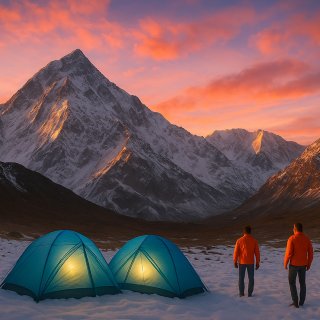
At the base village Lohajung, trekkers can stay in guesthouses or small lodges run by locals. During the trek, accommodation is in tented campsites set up in scenic locations like Bekaltal and Brahmatal. Tents are shared (2–3 people) and come with sleeping bags and mats. In winter, the experience of camping on snow under starry skies becomes one of the highlights of the trek.
Yes, trekking in the Brahmatal region requires permits from the Forest Department of Uttarakhand. These cover entry fees for the trekking routes that pass through forest zones. When booking with Trekking Compass, these permits are usually included in the package. Individual trekkers arranging the trek independently must secure the permits before starting.
The base camp is at Lohajung village, which is around 220 km from Kathgodam/Haldwani. From Kathgodam railway station, it takes 9–10 hours by road via Almora, Kausani, and Dewal. Shared jeeps, private taxis, and pre-arranged transport by trek operators are the usual options. Lohajung also serves as a starting point for other famous treks like Roopkund and Bedni Bugyal.
Since the maximum altitude is only 3,730 m, the risk of Acute Mountain Sickness (AMS) is minimal compared to treks like Roopkund or Bali Pass. Most trekkers do not face altitude-related problems if they stay hydrated, ascend gradually, and avoid overexertion. However, minor fatigue or headaches can occur due to cold and altitude change.
Yes, it is considered one of the safest Himalayan treks, especially for winters. The trail is well-established, campsites are relatively sheltered, and experienced trek leaders accompany groups. Still, trekkers must be prepared for sudden weather changes, as snowstorms can occasionally occur in peak winter. Carrying appropriate clothing and gear ensures safety.
While Kedarkantha Trek is more famous, Brahmatal is often preferred by those who want fewer crowds and a lake experience. Brahmatal offers the rare chance to camp near frozen alpine lakes, trek through dense rhododendron forests, and witness some of the best Himalayan panoramas without the overwhelming footfall that Kedarkantha sees in winter. It is also slightly longer and more immersive than Kedarkantha, giving trekkers a deeper connection with the landscape.
Our trek leaders are trained in first aid and equipped with oxygen cylinders and stretchers. The nearest medical facilities are available at Sankri, and evacuation arrangements are made if required. Travel insurance covering trekking is strongly advised.
Yes, trekkers who don’t wish to carry their backpack can opt for mule/porter services at an extra cost. This allows you to trek light while still enjoying the Brahmatal Trek experience.


We bring adventure to life with exciting treks in stunning locations to explore every trail's mummed secrets, with our friendly guides by your side.
Copyright 2018 - 2026 Trekking Compass | Design & Developed By Trekking Compass